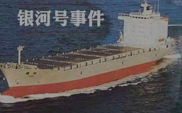
About 31 years ago, a Chinese container ship, the Yinhe, sailing to Iran, was left stranded in the Indian Ocean for 24 days due to the intervention of the United States. The vessel’s GPS was blocked, depriving the crew of navigational assistance.
This incident occurred in the early 1990s. At that time, the only navigation system available to most of the world’s population—including China—was the “Global Positioning System,” or GPS, developed in the United States.
Although the dynamics between the two nations were not as strained and competitive as today, the United States could not permit the vessel’s transit to Iran due to its apprehensions.
China is not the one to forget, as demonstrated by the Communist state’s narrative of remembering the “century of humiliation” that the nation had endured at the hands of foreign powers.
So, China did not move on from the 1993 Yinhe incident. While China’s idea of developing a satellite navigation system started in the 1980s, the Yinhe incident catalyzed its development.
China began working on its navigation system in 1994 in response to the humiliation caused by the incident, and six years later, it launched its first satellite in an experimental regional network.
What Was the Yinhe Incident?
In late July 1993, the United States claimed that the Central Intelligence Agency (CIA) had “conclusive evidence” that the Chinese container ship Yinhe was transporting chemical weapons material to the port of Bandar Abbas in Iran. Acting immediately on the intel, the US asked its Middle Eastern partners to refuse docking requests from the Chinese ship.
Due to pressure from the US Navy, the neighboring Middle Eastern nations refused to let the Yinhe dock, leaving it stranded in the Indian Ocean’s international waters for nearly a month.
At the same time, the US asked Yinhe to return to China with the alleged cargo load. A standoff started when China rejected the request after examining the ship and finding no evidence of chemical weapon material on board.
China vehemently refuted the unfounded charge directed against the ship by the United States. Nevertheless, the US firmly maintained that its intelligence was entirely accurate.
US military aircraft and warships allegedly pursued the Yinhe, disrupting its usual course. Additionally, the United States unilaterally disabled the Chinese vessel’s access to GPS, causing it to lose direction and anchor on the high seas for 24 days. The ship and its crew experienced a water and fuel shortage due to the unavailability of resupplies.
By August 8, 1993, China declared openly that US warships were conducting “intrusive surveillance” on the Yinhe in international waters. The US retorted that China’s public assertion of “surveillance” indicated an intention to have a showdown.
The US declared that it would continue to press China to recall the ship since it would be illegal for it to board the vessel for inspection.
After much discussion and repeated requests from the shipping firm, the vessel was granted permission to “take on fuel and water… to ensure the safety of the vessel and crew” on August 20, 1993, after being stranded in international waters for three weeks.
Fruits, vegetables, and freshwater were delivered on board a ship registered in the United Arab Emirates. The stand-off, however, continued for another week. A breakthrough was only achieved on August 28 when the ship docked at a Saudi port for inspection.
Representatives from all three nations, accompanied by an unnamed American technical advisor to the Saudis, inspected the vessel at the Saudi port of Dammam. On September 4, it was finally certified that the ship was free of hazardous cargo.
Following the certification and almost a month-long humiliation faced in international waters, China requested compensation for what it claimed was the disruption of its commerce by US warships and aircraft, denouncing the US for its “self-styled world cop” behavior.
In response, American officials declared that there would be “no apology” since their country had acted in good faith based on information from several sources that turned out to be false. According to the United States, the Yinhe left from a Chinese port carrying thiodiglycol, a base for mustard gas, and thionyl chloride, which is used to make nerve gas.
Thirty years later, China is working relentlessly to expand its BeiDou navigation system to prevent the repeat of a similar incident. When China started working on the Beidou network, the Chinese state-owned media regularly cited the Yinhe incident as justification for developing its satellite navigation.
Nonetheless, numerous Western scholars and analysts assert China’s intent to advance its navigation system began before the Yinhe incident. In the 1980s, Chen Fangyun and his colleagues proposed a Chinese satellite navigation system. It was believed that China was interested in adopting the GPS capability after observing its tactical advantage in the Gulf War in Iraq.
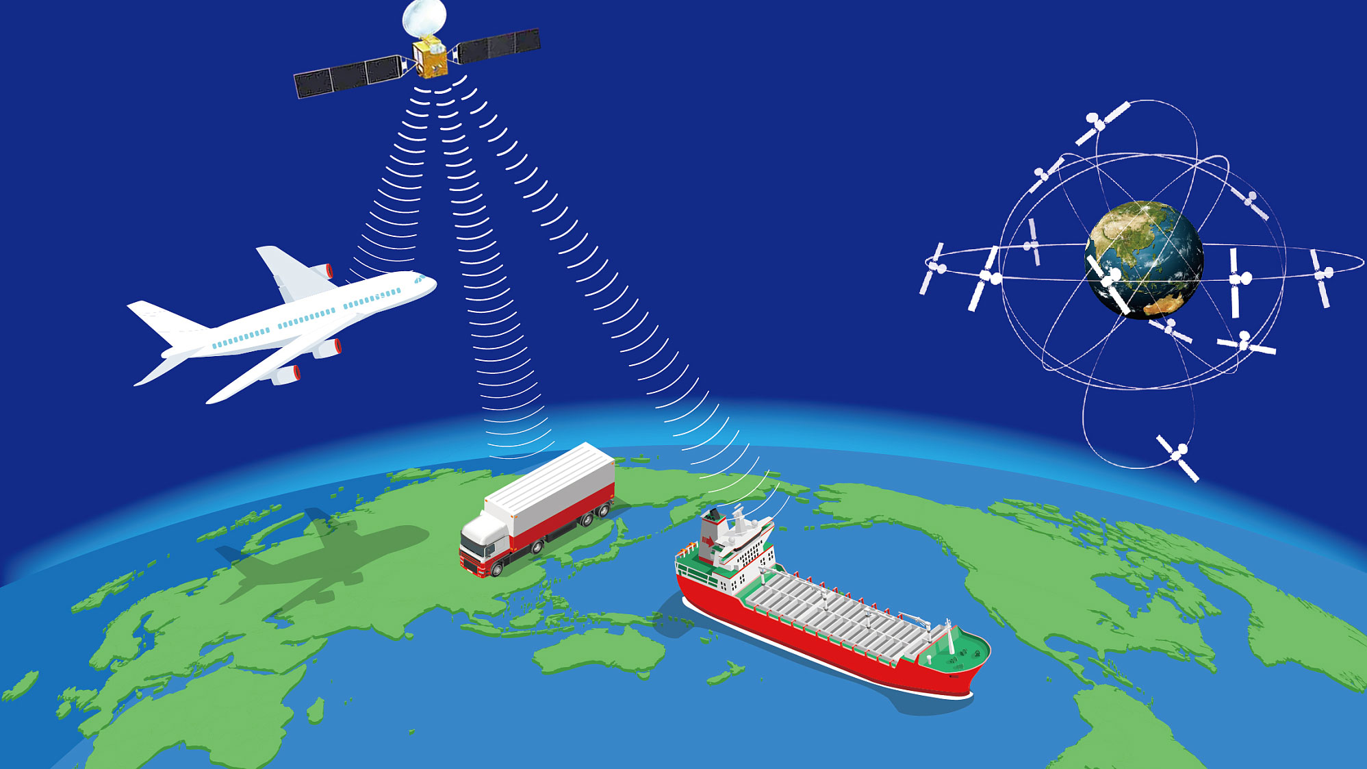
China has successfully established a comprehensive satellite navigation system that has expanded to such an extent that it is now poised to compete with the American GPS.
BeiDou Competes With GPS
China’s BeiDou System (BDS) was developed in three phases. Construction of BDS-1 and BDS-2 finished in 2002 and 2012, respectively. On July 31, 2020, BDS-3 was built and launched, making China the third nation with an autonomous global navigation satellite system.
According to the Belfer Center for Science and International Affairs at Harvard University, China’s satellite constellation, which covers the entire globe, has achieved a level of accuracy that surpasses GPS in various areas.
In a remarkable turnaround, the 600-ship China Ocean Shipping Company (COSCO), which owns the Yinhe, has outfitted its fleet with signal receivers made in the United States. Currently, most Chinese ships are using BeiDou instead of GPS or both.

BeiDou’s profile reached a significant milestone in November 2022 as it was integrated into the Cospas-Sarsat worldwide search and rescue network, making it the fourth system in the world, behind GPS, Europe’s Galileo, and Russia’s Glonass. Further, the International Civil Aviation Organization also acknowledged China’s method as a global standard for flight guidance last year.
China’s BeiDou satellite constellation has 56 in orbit, making it almost twice as large as GPS. It also has more than ten times as many monitoring stations, many in developing countries.
The bigger size of BeiDou over GPS is a significant advantage. In many parts of the world, Beidou’s wider constellation provides higher PNT (Positioning, Navigation, and Timing) data availability and, in some situations, greater accuracy, according to a Belfer Center analysis. This is particularly true in Southeast Asian and African nations, which have traditionally received inadequate GPS coverage. In 2020, BeiDou “eclipsed” GPS in 165 countries, according to a Nikkei Asia report.
China also plans to improve Beidou’s accuracy, security, and dependability. The objectives encompass the implementation of novel inertial sensors and the integration of emerging technologies, such as quantum navigation, in addition to establishing low-Earth orbit (LEO) networks.
With the launch of its trial version, China’s national Beidou high-precision navigation and positioning service platform marks a significant advancement in the nation’s in-house satellite navigation capabilities.
- Contact the author at sakshi.tiwari9555 (at) gmail.com
- Follow EurAsian Times on Google News


