Swedish defense and aerospace company Saab, which has manufactured Gripen fighter jets, is upgrading its existing terrain navigation system or Ternav to make it work in GPS-denied areas.
Air forces across the world have recognized the emerging threat of GPS jamming which is considered a part of electronic warfare (EW).
F-15 Strike Eagle Jet Demonstrates Capability To ‘Wipe Out’ Terror Facilities With ‘Heavy-Duty’ GBU-72 5K Penetrator Bomb
EW can broadly be defined as the use of the electromagnetic spectrum in an attack. This may include the use of x-rays, visible light, infrared, microwaves, and radio waves.
EW can be broken down into three distinct categories — electronic countermeasures (ECM), electronic counter-countermeasures (ECCM), and electronic support measures (ESM). The aim is to impede the enemy from leveraging the electromagnetic spectrum while ensuring its utility by the initiating side.
Satellite-based position, navigation, and timing (PNT) is one of the most progressive technological advancements in the past 50 years. There are country-specific PNT satellites, also called Global Navigation Satellite Systems (GNSS), such as the American GPS, European Galileo, Russian GLONASS, Chinese BeiDou, and the Indian IRNSS/NavIC.
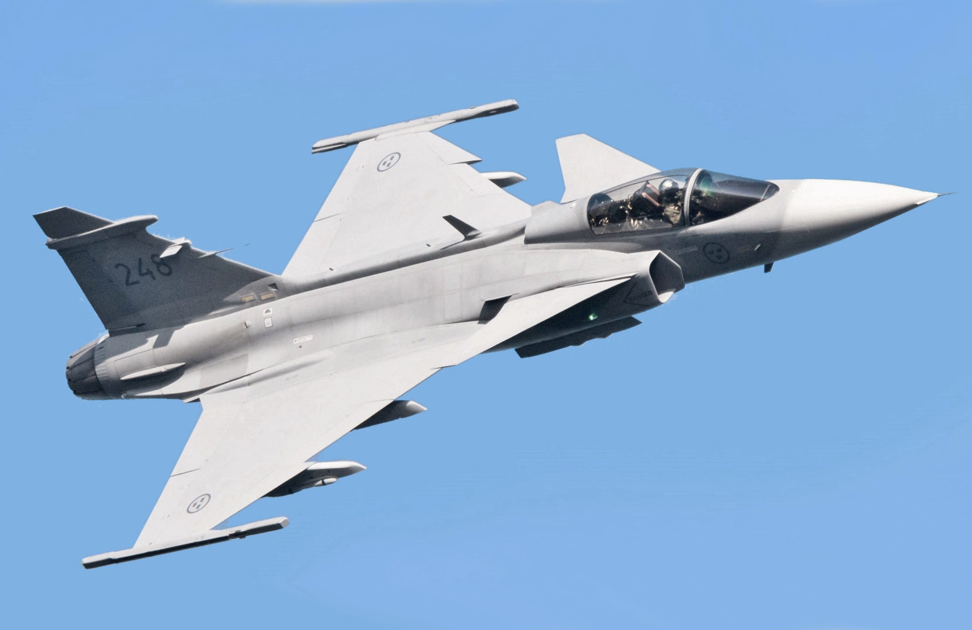
Aviators throughout the world use the American GPS. The Indian military including the Air Force uses the homegrown NAVIC system, which is supposedly spoof and jam-resistant, as an alternative to the GPS. Its rival Pakistan, however, continues to depend on GPS.
USAF Gets High-Powered Laser Weapon On Its Ghostrider Aircraft; Says Can ‘Knock Out’ Enemy Defenses In A Jiffy
Umair Aslam, a Rawalpindi-based strategic affairs researcher told The EurAsian Times about the need for such technology. “Electronic Warfare plays a vital role in modern warfare. Recently, we had seen the advantages and disadvantages of Electronic Warfare during Operation Swift Retort [in 2019]. During the operation, Pakistan used DA-20 and Saab-2000s in EW domain and these aircraft played their role very well.”
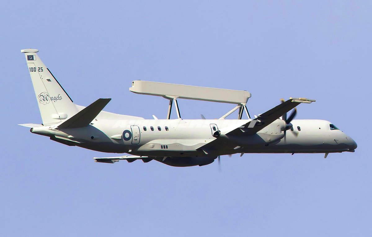
“PAF revealed that it used DA-20 EW aircraft to jam Indian Communication. This helped PAF pilots to carry out their ground attack missions in a successful manner. The communication between IAF pilots, Air Defence controllers, and AWAC&S was jammed by PAF’s DA-20, thus PAF achieved its goals very well,” Aslam said.
Indian Air Force spokesperson Wing Commander Ashish Moghe did not respond to a query sent by this writer till the filing of this report. His comment will be incorporated as and when it is received.
Needless to say, GPS jamming poses a new threat to modern air assets. Saab has offered upgraded navigation capabilities to help Gripen operators tackle these challenges over the decade. Jonas Jakobsson, an experimental test pilot with Gripen, explained the importance of platform position.
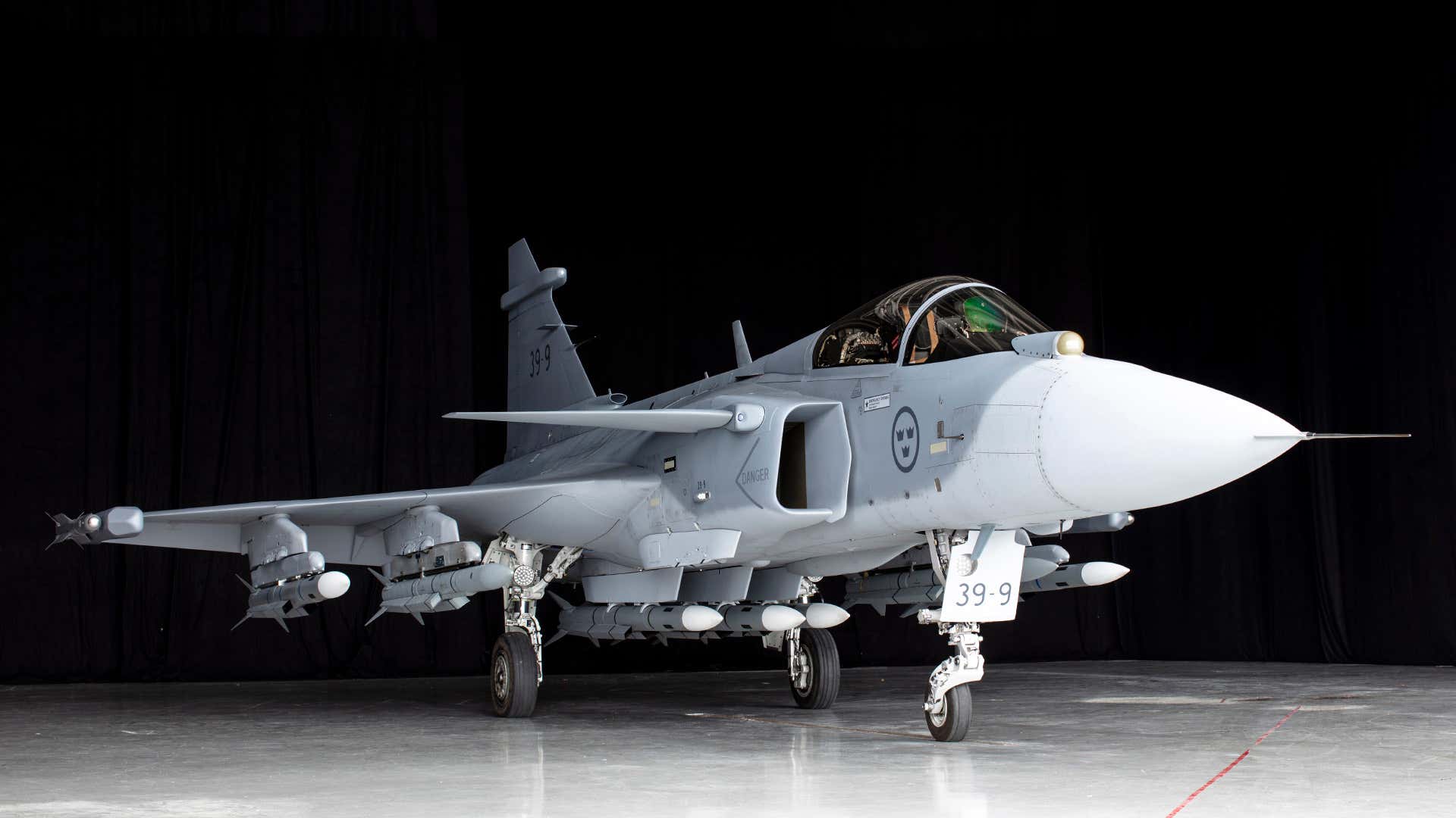
The pilot emphasized the need for pinpoint accuracy and how even mere meters make all the difference. Jakobsson explained how global navigation satellite systems had been a longstanding solution and GPS had generally been delivered. However, wargames in Scandinavia have highlighted how the jamming of GPS can be a gamechanger.
Despite Rafale Boost, Why Indian Air Force Remains ‘Ill-Equipped’ To Battle Chinese PLAAF Over The LAC?
Environmental factors such as solar flares may also play a role in such disruptions. In sensitive air operations, the margin for error remains incredibly low and even a minor one may have far-reaching consequences resulting in collateral damage. Saab is currently working towards mitigating these types of anti-access/area denial (A2/AD) tactics.
What Is Saab Proposing?
According to a report, Saab intends to pool inputs from its existing Ternav terrain navigation system, real-time odometry imager from a camera installation coupled with a 3D mapping surface model supplied by Maxar Technologies via a sensor fusion database.
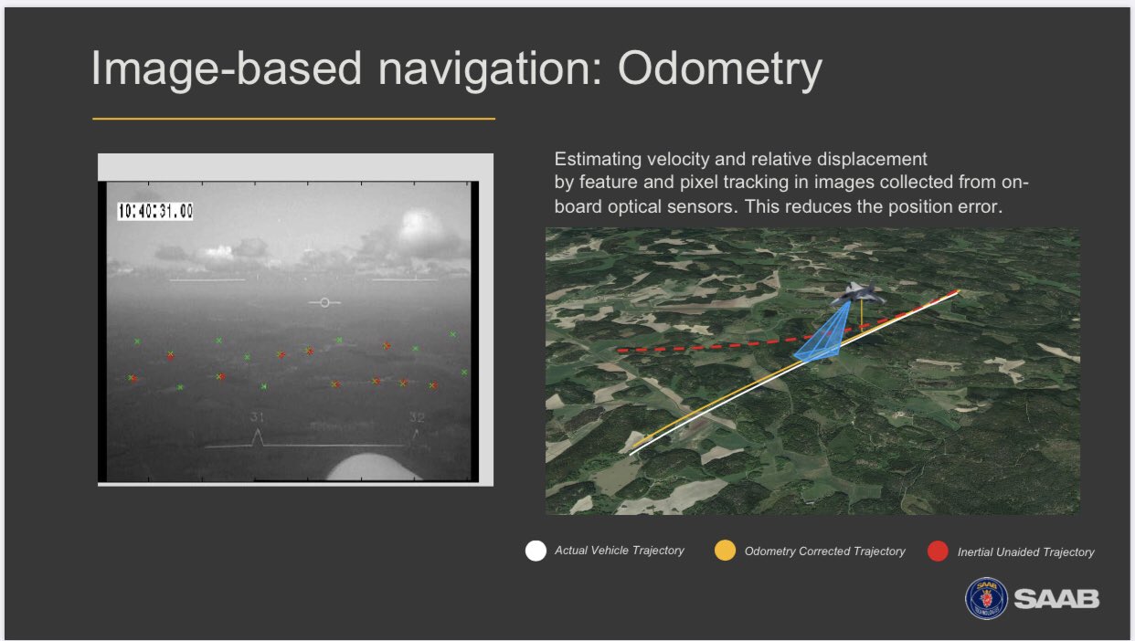
The company claims that this will provide a far more significant positional accuracy than using traditional inertial measurement unit equipment. Both Saab and Maxar carried out flight testing using pod-mounted cameras in 2018. This was done to evaluate the system’s potentiality.
Work on this was expanded in 2020 to carry out real-time processing with the airframer’s Gripen E/F demonstrator aircraft. Tobias Jansson, a product manager at Gripen, said that the project was successful and announced that further flight testing could take place in a year.
F-35 Stealth Jets Plagued By Engine Issues; Will USAF Dump ‘Low Yield’ Pratt & Whitney Engines For GE’s XA100?
What Is Ternav?
The company’s terrain navigation know-how dates back to the 1980s amid the production of Viggen fighter jets. This technology was upgraded for the Gripen program; however, Sweden had not adopted it.
The country continued to rely on the GPS system. Complete GNSS-denied navigation capabilities have been offered to Finland as part of the Swedish aerospace company’s HX program, Jansson revealed.
The program offers 64 Gripen Es and two GlobalEye surveillance aircraft. This capability is crucial for nations, which are in proximity to adversaries who possess GPS jamming capabilities, Jansson added.
This system is likely to further support air operations using dispersed bases and is in accordance with a tactic employed by Finnish and Swedish to mitigate strikes on critical air bases, the Gripen test pilot claimed.
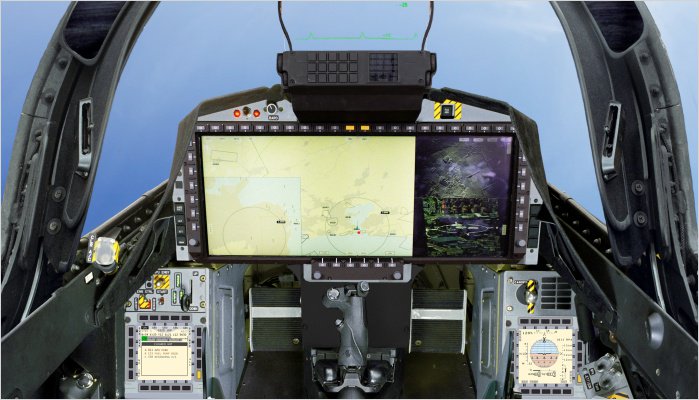
Feasibility studies have been carried out and the company believes that such off-the-grid, automatic instrument meteorological conditions approach and landing functions are likely to translate effectively in wartime environments.
Full operational capability is expected within three to five years. According to Jansson, an odometry-based solution also would be fairly straightforward to introduce for the Gripen C/D.
He believes that these can be achieved through software updates. Existing Gripen users have reportedly expressed interest in this novel technology. The company remains optimistic about this development and goes on to note that the technology may not be merely limited to the Gripen.
Instead, such navigational innovations may even see potential incorporation in the GlobalEye and unmanned air vehicles, plus air-launched weapons.

Will Pakistan Use Ternav?
Defense industry sources told the EurAsian Times that the Saab uses the Ternav system, which works as an alternative to the US GNSS or simply the GPS.
Saab’s offering is believed to be resistant to jamming and is not dependent on external infrastructure. The system is based on algorithms, which are fed by a new radar altimeter and a laser altimeter.
US Getting Capability To Strike Deep Into China ‘Within Seconds’ With Its New Hypersonic Missile ‘Dark Eagle’
It is a new concept and it is SAAB’s initiative of implementing an inertial navigation system. Saab has been using the system for many decades however the company now feels that it has reached the accuracy levels of the GPS.
The key highlight is the aircraft can perform its own navigation without relying on outside systems like fixed towers or satellites etc. Saab’s Ternav backbone is an algorithm fed by radar and laser altimeter. It is the company’s own version of the inertial navigation system.
Pakistan Air Force uses the Saab-2000 Airborne Early-Warning & Control (AEW&C) aircraft, which gives rise to the possibility that the service might adopt Saab Ternav for its aerial fleet. India might not be a potential customer as it uses the NAVIC system.
There is another speculation that Pakistan might opt for the Chinese BeiDou navigation system. A Pakistani analyst also echoed this view. Nevertheless, it is too early to speculate on the Ternav technology and its potential clientele, given it is far from operational.
- Aritra Banerjee is a defense journalist who has worked in both online and print media. He has laid an emphasis on issues related to military human resources, tactical psychology, military-media relations, professional military education, and combat fitness. He can be reached on email: aritrareporter@gmail.com.
- Follow EurAsian Times on Google News


