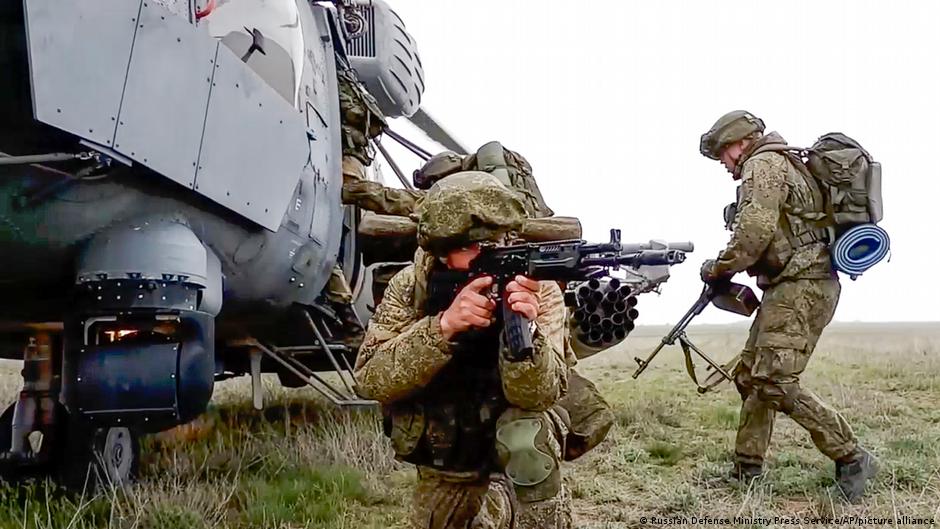
The Russian Defense Ministry recently released a video claiming its troops were being withdrawn from Crimea and they were returning to base. However, the United States and NATO maintain that the crisis is far from over as the build-up along the Ukrainian border still exceeds a million troops.
Amid concerns that Russia could invade Ukraine anytime, new satellite imagery obtained through Open-Source Intelligence (OSINT) lends credence to western apprehension.
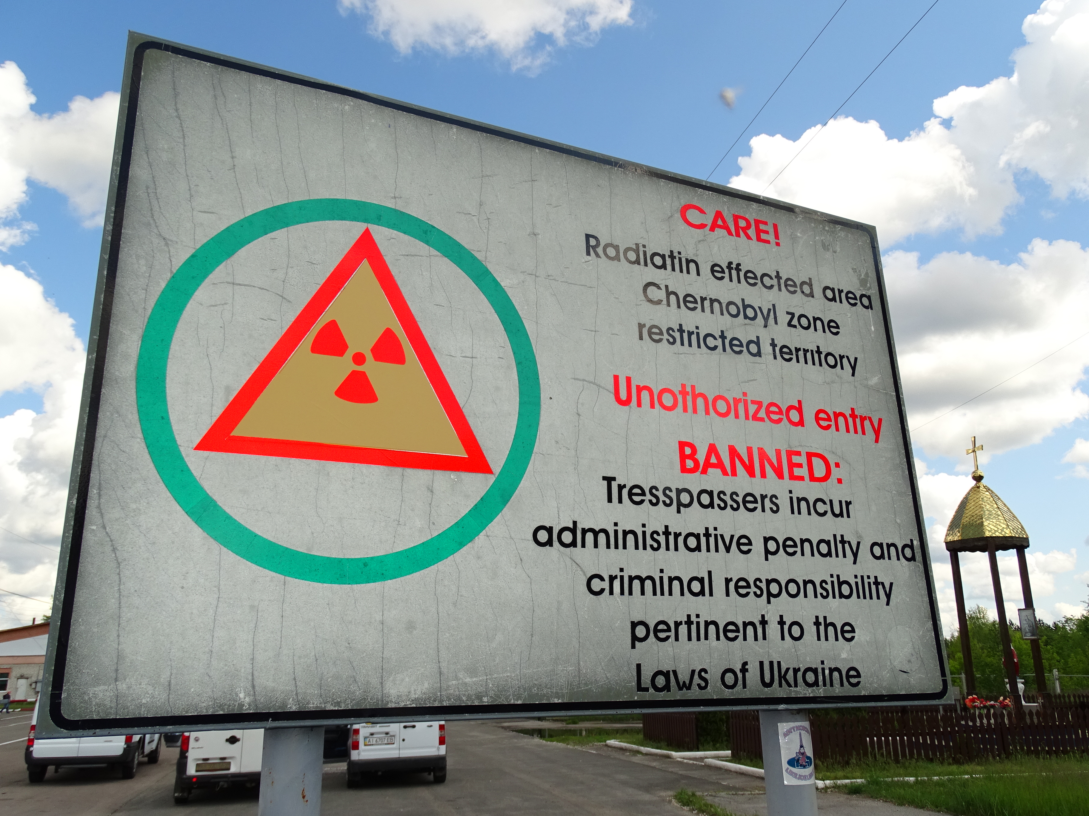
While Russian troops had already encircled Ukraine from three sides, OSINT images indicate that they also created a new access area from Belarus to Ukraine via the Chernobyl Exclusive Zone.
A pontoon bridge could be seen in the satellite images crossing a potentially strategic section of the Pripyat River in Belarus. There is a strong possibility that the Russian side has built this bridge in collaboration with Belarusian forces.
A pontoon bridge is a floating bridge that is primarily used by the military. It is a temporary structure to cross a river by linking two territories for swift access. It was very popular with the Red Army in the Soviet era.
It’s unclear if this makeshift bridge is still in use. But it is significant because this section of the river is less than two and a half miles north of the Ukrainian border and also lies within Belarus’ Polesie State Radio-Ecological Reserve.

Due to the Chernobyl nuclear disaster in 1986, both the Belarusian territory and the neighboring exclusion zone in Ukraine were significantly contaminated due to radiation. These territories are uninhabited and resemble ghost towns. Chernobyl Exclusive Zone is the world’s most radioactive contaminated area.
According to @NATO, the Russian Federation has concentrated 100,000 troops around #Ukraine. Another 30 thousand people, according to the alliance, #Russia has already transferred or intends to move to #Belarus as part of the joint exercises "Allied Resolve – 2022". pic.twitter.com/B835VclIuS
— NEXTA (@nexta_tv) February 13, 2022
Russia and Belarus are conducting a 10-day military exercise called the ‘Allied Resolve-2022’. The western nations recently issued a warning that these military drills were a precursor to an invasion of Ukraine, but Russia has repeatedly denied such claims. The pontoon bridge could provide the Russian troops with unique access to Ukraine.
Appearance And Disappearance Of a Pontoon
Images of the bridge first surfaced on social media on February 15. Satellite photographs from Planet Labs indicated that the bridge was built between February 14 and 15, 2022. The work for cleaning land on both sides of the river was completed a day before.
Recent Planet imagery of the Pripyat river in Belarus near the RU-UA border shows a new bridge having been constructed earlier today. https://t.co/JFRxhEUW0j pic.twitter.com/cMTpMGrkHP
— Emma Smith (@ameliairheart) February 16, 2022
Earlier, satellite photographs from January 8 had showed no traces of any preparations for the bridge, hinting that it all started rather recently. High-resolution photographs from Maxar, which surfaced online on February 16, show it’s a PMP-series pontoon bridge.
New @Maxar satellite images from the past 48 hours continue to show heightened military activity in Belarus, Crimea, and western Russia. Pics below are from Feb. 15 and show a new pontoon bridge over the Prypyat River in Belarus. pic.twitter.com/8GCvBMtG4y
— Christopher Miller (@ChristopherJM) February 16, 2022
In recent weeks, videos and photos have also surfaced on social media showing the Russian soldiers transporting parts of PMP as well as TMM-3 bridge systems, among other things. These parts can be linked to form bridges of varying lengths.
It’s unclear whether the Pontoon bridge still exists. Commercial supplier Sentinel Hub’s radar satellite imagery of this area captured on February 16 implies it has already been removed.
The ease with which it could be taken down and erected in the first place underlines how simple it would be to reinstall in the future.
Furthermore, while the health risks to troops operating in this region of the reserve are unknown, it’s likely that they would be tested for any potential exposure to radiation.
Ukraine’s security forces performed their own training earlier this month at Pripyat, a city near the now-defunct Chernobyl nuclear power plant.
The rationale behind either side choosing this hazardous zone for practice could be the lack of human settlements in this region and the general isolation due to geographical barriers.
“This area is very hard to get through – forests, swamp, rivers – it’s complicated enough to move by foot let alone with a tank,” Ukrainian Defense Minister Oleksiy Reznikov had told journalists previously. “And don’t forget that still since the disaster there remains some highly radioactive areas on the route from Belarus.”
This indicates that Ukraine had not been anticipating any Russian entry into its mainland through this route at the time when these comments were made. However, the satellite images and the alacrity of the Russian forces in erecting and dismantling the pontoon bridge could possibly change that assessment.
It might also be interesting to note how Kyiv would plan on defending its territory from this route given the severe hazardous concerns attached to it.
Overnight, US (and British) officials said Russia was NOT pulling back forces, as previously announced, rather had added around 7K troops this week. 📸 Maxar released new sat imagery purportedly documenting this and other stuff, incl. a new military pontoon bridge near Pripyat. pic.twitter.com/fhNceZZ8xS
— Mike Eckel (@Mike_Eckel) February 17, 2022
Meanwhile, Russian President Vladimir Putin sounded an optimistic note after meeting his French counterpart Emmanuel Macron and NATO Secretary-General Jens Stoltenberg. However, the US remains apprehensive and the latest satellite images could only add to the western concerns.
- Contact the author at sakshi.tiwari9555@gmail.com
- Follow EurAsian Times on Google News


